Recently it‘s been reported that there has been a global surge in jamming and spoofing incidents affecting smartphones, commercial aircraft and shipping, and generally disrupting civilian life. These reports are being commonly attributed to military interference through global navigation satellite systems (GNSS) jamming, predominantly in regions close to the Russia/Ukraine and Israel/Palestine conflicts.
Globally, we are heavily reliant on GNSS for precision navigation and timing (PNT) services, both for critical infrastructure and military operations, as well as for our everyday connectivity devices. However, GNSS signals are typically low power when they reach the receiver, making them vulnerable to both deliberate and accidental interference deception, and spoofing.
The wars in Ukraine and Palestine have confirmed a long-held fear that jamming/spoofing of GNSS signals is effective. Commercially available jammers are now common within the civilian market ensuring that GNSS degradation can be propagated by a broader group and not just state actors. But how can we protect military and civilian groups from these attacks?
Resilient Precision, Navigation and Timing (RPNT) at Roke
Roke is a world leader in creating resilience within GNSS systems as well as developing Alternative Navigation solutions. RPNT allows enhanced accuracy to both civilian and military user groups and is a significant enabler to protect against this growing threat.
We created the world’s first Anti Jam GPS receiver in 1984 and have consistently been at the forefront of Navigation Protection research in the 40 years since. We’re also pioneering Alternative Navigation technologies that are GPS independent which will offer true navigational freedom to the user. Read on to find out just some of the ways RPNT can be used to defend against jamming and spoofing.
The Roke Intelligence advantage
The first step to tackling spoofing attacks is to be able to detect them in the first place! Our Roke Intelligence team combines geospatial data, human expertise with advanced Artificial Intelligence (AI), Machine Learning (ML) and sensor technology to uncover hidden patterns of activity and find hostile actors quickly and efficiently.
By providing instant access to accurate real-time information and pinpoint location certainty through solutions like Geollect, the Roke Intelligence team has a long history of identifying spoofing attacks globally.
From detecting manipulated Automatic Identification System (AIS) positions over a Russian held airfield within Crimea to locating Venezuelan sanctions evasion off the coast of Venezuela and West Africa, the Roke Intelligence advantage means our clients know first, know where, and know more.

Machine Learning (ML) for anti-spoofing and jamming
Machine Learning systems are an increasing commonality throughout industry, public and private, with applications including aircraft engine inspection and self-driving cars, but did you know that they can be applied in RPNT too?
Our engineers are actively developing ML algorithms that enable the resilience of GNSS. In fact, we created a proof of concept for a customer using ML techniques to discriminate legitimate users of services from those attempting to spoof the system by falsifying data to gain an illegitimate advantage.
Our research offered the potential to discriminate individual satellite communication (SATCOM) emitters/spoofers in the same geographic area, based on the unique “fingerprint” of the transmitter – independently of any claimed identity in the signal data. This is applicable to existing and future SATCOM receivers as additional software-based signal processing, either at a ground terminal (downlink) or at the satellite itself (uplink). It enhanced communications security and resource availability for legitimate users and supports valuable intelligence gathering on spoofers.

Enhanced Long Range Navigation (eLORAN) and Mini eLoran Receiver (MILOR)
Long Range Navigation (LORAN) was a system originally developed in World War 2 and was based on a chain of stations transmitting radio signals that enable a receiver to triangulate its position. eLORAN is a more advanced version of LORAN that has significantly advanced receiver design and transmission characteristics increasing the accuracy and usefulness of traditional LORAN.
Roke has developed eLORAN receivers since the 1980s, and our work here has propelled the technology forward considerably by offering greater redundancy for navigational accuracy outside of GNSS for land, maritime and air assets.
A particular feature of our eLORAN receivers is their low Size, Weight and Power (SWaP) requirements, making them portable and usable on the fly. A particular advancement in this area is our MILOR system which combines a miniature antenna and miniature processing module which uses efficient algorithms to process the eLoran signals, making it the smallest eLORAN receiver ever.

Alternate navigation
Navigation is a common part of everyday life, from the GPS enabled systems found on all modern smartphones, to the state-of-the-art systems used in commercial air travel and in cars. But as we know, GNSS signals are not always reliable in every environment and are susceptible to spoofing attacks.
That’s why we’re leading the way to develop systems that can operate in GNSS denied environments, without the need for GNSS – if a system doesn’t use them then it can’t be jammed in the traditional way!
But how are we doing this?

Satellite Signals of Opportunity (SatSOP)
Stronger satellite signals at similar frequencies can be used to supplement and take over from GNSS signals, creating signals of opportunity to support positioning and timing. They are designed to communicate with small terminals such as satellite phones or modems, so can be processed to a similar size as a traditional GNSS receiver. Unlike terrestrial signals of opportunity like TV transmitters or mobile base stations, satellite signals have the advantages of providing global coverage and are not vulnerable to local power disruptions or outages.
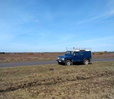
We have constructed a prototype antenna array capable of receiving satellite signals from a range of different sources. This enables measurement of direction, Doppler and propagation time for each satellite.
This research showed that that is possible to exploit the transmissions from the existing satellite constellations to achieve navigation and timing for a moving platform. This is currently realised using an antenna array but could be achieved from a single antenna for more lower SWaP (Size, Weight and Power) solutions such UxVs (Uncrewed Vehicles) or dismounted on the soldier. We are currently working to further improve positioning accuracy by exploiting more satellite signals and to mature the concept to higher Technology Readiness Levels (TRL), in collaboration with users and industry partners.
Roke Exploration Navigation System (RENS)
In circumstances where GNSS is not available, for example, when underground, in large buildings or when GNSS is disrupted, alternative navigation approaches are needed. We’ve used our heritage in computer vision to create the Roke Exploration Navigation System (RENS), a novel system that combines inertial navigation (movement sensors) with video analytics to create a system capable of locating itself, tracking movement and understanding orientation without reference to any external navigation systems.
RENS is an entirely self-contained location and navigation system, delivered as a small matchbox-size unit, using widely available low-cost components. It can be attached to a user or a vehicle, allowing their location to be monitored, and applications range from car navigation to a firefighter building egress aid.
RENS is currently integrated in our Charlie Charlie One (CC1) product, a secure End User Device (EUD) designed to provide enhanced situational awareness at the tactical edge. RENS provides resilience to the CC1 system, allowing operators to deliver battle-winning advantage to tactical decision makers in GNSS-denied environments.

Get in touch
These attacks are becoming an increasingly common factor of everyday life, but the means to counter them are out there and available via Roke technology and expertise.
Contact us now to find out how we can make your systems more resilient:
Related news, insights and innovations
Find out more about our cutting-edge expertise.


